Route optimisation
Advanced technology for smart, dynamic and cost-effective route planning
Advanced technology for smart, dynamic and cost-effective route planning
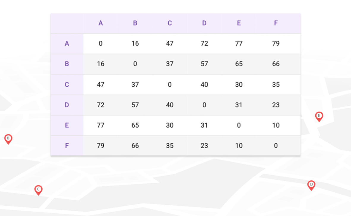
Matrices
Massive matrix calculation of distances and travel times between all points of the matrix:

Map matching and analysis
Analysis of a vehicle’s historical route, based on its GPS track:
• Transform a GPS route into a route on main roads.
• Assign a vehicle status to each section of the route, for its differentiated visual representation on the map.
• Analyse possible excess speed of the vehicle, respecting the margins to be defined.
Isochrons
Calculation of zones of proximity to a coordinate, either by defining a travel time or a distance. Different forms of travel can be defined:

Optimisation and planning
The platform provides different levels of route optimisation:
SDK
Navigation SDK for Android and iOS provided by TomTom, integrated in your own app:
• Navigation and specific routes for different types of vehicles, including trucks.
• Maps in the cloud, always updated to the latest version.
• Real-time traffic data.
• Possibility to force the optimisation of the order of visiting points.
• Lane information for complex manoeuvres.
• Fixed speed camera warning.
• Voice-guided.
• No registration fees. Monthly billing per vehicle.