Real estate agencies
High-quality maps and complementary services for web portals and internal applications
High-quality maps and complementary services for web portals and internal applications

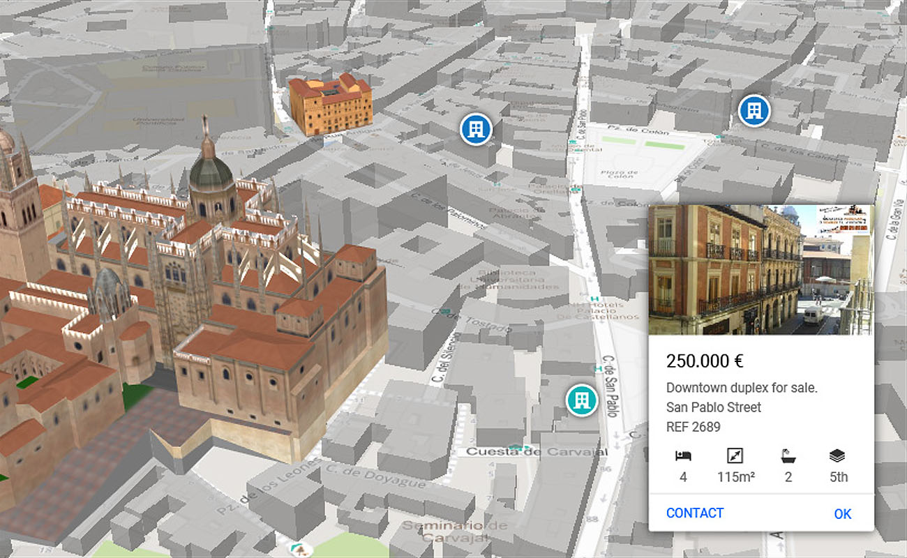
Detailed 3D buildings and land

Interactive by day and time

Different styles of maps

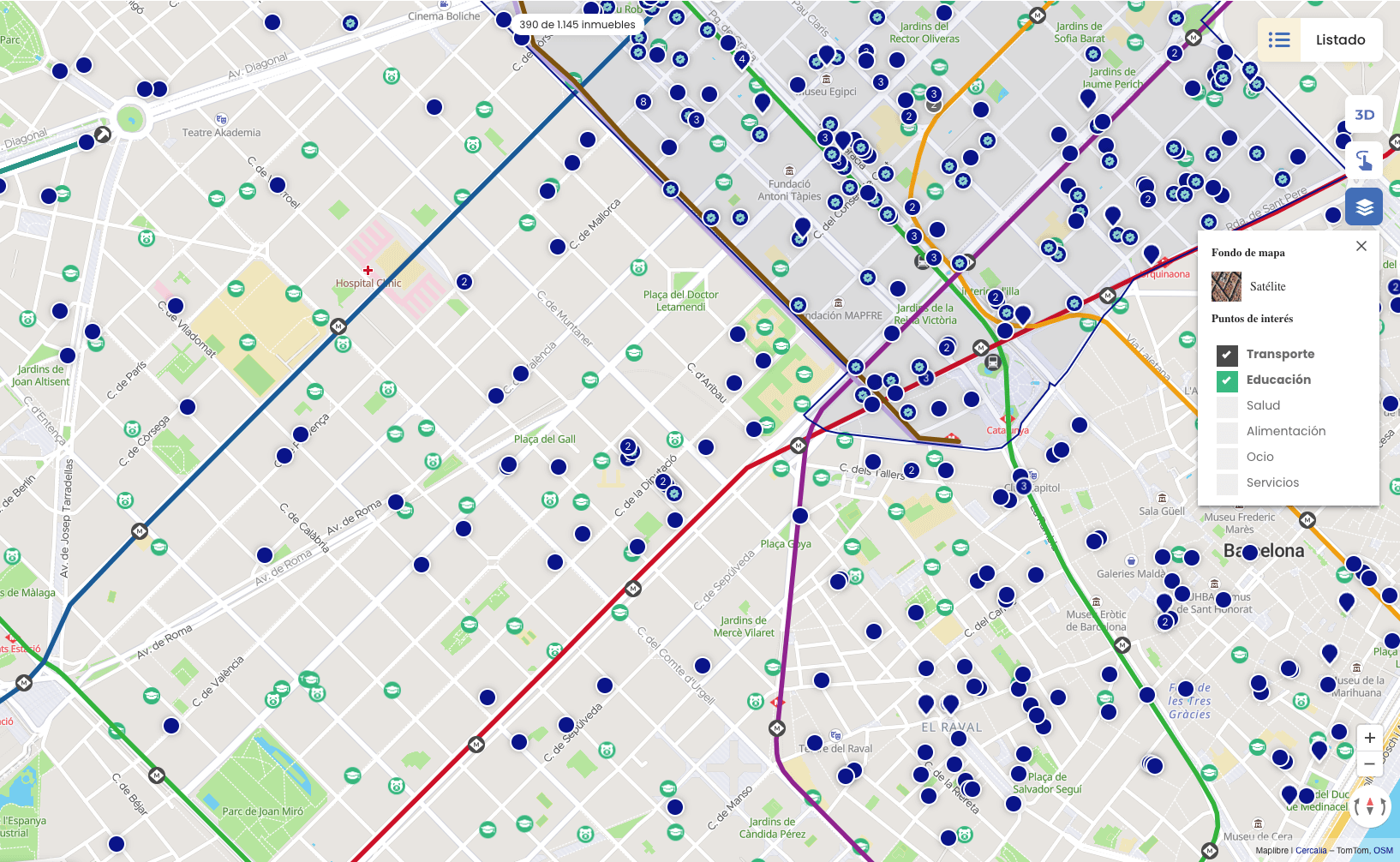
Categorised POIs

Cadastral layer on the map
API js
Customise content using powerful tools to handle large volumes of information and tailor to multiple languages and formats.
• Full GL js API
• Multi-language
• Vector maps
• Ability to paint large volumes of information

Own style

Dark style

Google Style v1

Silver Style

Aerial photo

Google Style v2
3D representation
Displays cities, landmarks and environments with realistic textures and day and time-dependent sunlight projections. Impress your customers with a high level of detail.
POIs
Access an up-to-date database with the main categories of points of interest to highlight the surrounding area of each property.
• Educational facilities: schools, colleges and universities.
• Health services: hospitals, clinics and pharmacies.
• Transport: underground stations, buses and main roads.
• Leisure and culture: parks, theatres, cinemas and sports centres.
• Groceries and shopping: supermarkets, restaurants and local markets.

Proximity
Three options to calculate the real proximity of points of interest and improve real estate decision-making:
• Isochron calculation: determines travel times on foot, by car or by bicycle.
• Bulk calculation: analyses the actual distance of multiple points of interest to a property.
• Geofencing: delimit areas or polygons for customised searches.
Autocomplete
Optimise the search on your platform with a suggestion system based on your company’s geographic master. Find neighbourhoods, municipalities or provinces quickly and efficiently, prioritising information according to its relevance.
• We implement a suggest-like search system with real-time suggestions.
• Results organised by geographical category: neighbourhood, municipality, county, province.
• Prioritisation of items according to their importance and relevance.
• We include geographic polygons for display on interactive maps.


Neighbourhood layer
Access detailed polygons of neighbourhoods in cities with more than 200,000 inhabitants and provincial capitals in Spain. An ideal tool for interactive maps and geographic identification in real estate portals.